Selected Reprints
The Farmington Canal
by Jim Trocchi
Perhaps the largest historical archaeological feature in Connecticut is the abandoned Farmington Canal. It was in
operation from 1828 to 1848. The canal was built to connect New Haven Harbor to inland commerce and divert some of the
business away from the
Connecticut River.
Searching for its remains is a wonderful activity for people who like to explore and experience history first hand.
The best time of the year to explore is in the late fall until early spring, when vegetation is defoliated. You will
essentially be seeking the remains of a trench that was initially dug to the dimensions of 36 ft. wide on top, 24 ft. wide
on the bottom and 4 ft. deep. A berm bordered one side and a 10-foot wide towpath bordered the other side. Of course, these
dimensions have become diminutive over time.
 The Farmington Canal stretched from New Haven Harbor and continued north to the Massachusetts border, where it joined
the Hampshire and Hampden canal, and then on to North Hampton, MA joining the Connecticut River. It was 80 miles long with
56 miles of it in Connecticut. This was the longest canal built in New England and it went through eight Connecticut towns:
West Suffield, Granby, Simsbury, Avon, Farmington, Southington, Plainville, Cheshire, Hamden and New Haven. Plainville
separated from Farmington in 1869, after the canal ceased operations.
The Farmington Canal stretched from New Haven Harbor and continued north to the Massachusetts border, where it joined
the Hampshire and Hampden canal, and then on to North Hampton, MA joining the Connecticut River. It was 80 miles long with
56 miles of it in Connecticut. This was the longest canal built in New England and it went through eight Connecticut towns:
West Suffield, Granby, Simsbury, Avon, Farmington, Southington, Plainville, Cheshire, Hamden and New Haven. Plainville
separated from Farmington in 1869, after the canal ceased operations.
Since the canal's abandonment in 1848, much of it has been lost to nature and human development. But, fortunately,
there is still much remaining to experience, not only in the engineered water channel itself, but also in the remains of
locks, culverts, aqueducts, hotels and taverns. The highlights that follow are just a few of the features you can observe
just in northern Connecticut.
To get oriented in finding the canal's abandoned remains, go to the library reference section and copy the aerial
topography maps of all the towns listed above. On many of these maps, "abandoned canal" is denoted in most areas where its
remains are still visible. The canal follows close to the vicinity of CT/MA Route 10. Therefore, with camera in hand, park
the car at some convenient point and get ready for an adventure close to home.
I will start the highlights of our journey at the Congamond Lakes near the CT/MA border and briefly describe what you
can expect to see in the northern portion of Connecticut. The Farmington Canal got its name because the major source of its
water came from the Farmington River and its tributaries. But the Congamond Lakes were also a huge source. They are 220
feet above sea level and its all downhill from here to New Haven Harbor. The Lake was part of the canal waterway. Horses
trotting on a floating towpath pulled the canal boats through it. At the southernmost point of the Lake is an outlet where
the southern route of the waterway heads into Connecticut and starts the beginning of our state's portion of the canal
system. You will see a stone marker indicating MA/CT border and a large swampy area that once fed additional water needed
to keep the canal filled. Continuing south this unnaturally straight waterway is pronounced until the old railroad
abutments at Phelps Road in West Suffield. Here the canal route ends and its former channel is amputated and flows into a
natural brook. Continuing south into Granby on Quarry and Hungary Roads is a Granby Land Trust sign denoting the location
of a preserved section of the canal. Additionally, side streets off the above roads intersect the old canal bed and can be
easily seen and photographed.
Just north of the former Granby Station, on Route 189, locks 1 through 6 once existed. They are difficult to
distinguish because locals have long reused nearly all the masonry work. These 6 locks lowered the canal bed from 220 feet
to 180 feet. The next lock is not encountered for another 30 miles in Southington.
Before we leave Granby we encounter Salmon Brook where a 40-foot culvert carried the canal bed. This culvert was the
largest on its 80-mile course and endured over a hundred years of service for the canal and the later railroad. After flood
damage in the 1930s, the culvert was replaced by a steel bridge, which still stands and is being converted for rail to
trail use. A small section of the 40-foot culvert still remains, and is easily spotted from the steel bridge. It is my hope
that this masonry will be preserved.
In Simsbury, the canal existed close to the Route 10 roadway and therefore has disappeared because of road expansion
and development along it. But you still can view the remains of a section north of town near Simsbury Airport and another
at the Canal Place housing complex in Weatogue. Also, the substantial remains of a culvert over Hop Brook, across from
Ensign Bickford, can be seen.
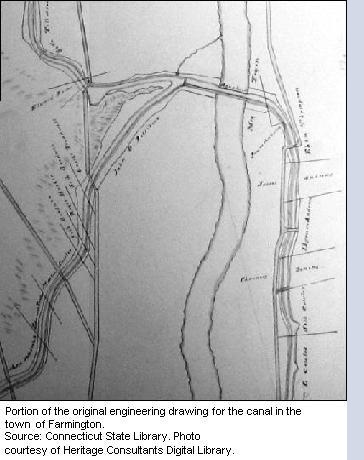
The Avon Old Farms School has left much of the canal bed undisturbed and it is preserved in heavy growth. Also, the
substantial remains of another culvert can be seen just before you leave Avon and enter Farmington. Some key remains in
Farmington are the aqueduct and the Unionville feeder canal. On the west side of the Farmington River banks, behind the
Farmington Club complex, and on the east side off Route 10, the aqueduct abutment wings can be seen. Additionally, from the
club's parking lot, the profile of the feeder canal can be observed in the distance. Further down on Route 10, Miss
Porter's School has abuilding that was once the Union Hotel that served canal travelers.
The town that is most proud of its canal heritage is Plainville. At Norton Park they have preserved the canal bed and
keep it well trimmed and mowed to prevent it from being overgrown. Every applicable street in town has signage to denote
the canal's former path through town.
There is more to be seen south of Plainville such as the beautiful restoration of lock 12 in Cheshire with its
gatekeeper's house and a small museum. These highlights are just a sample of what you can view. There are many more obvious
remains and not enough space to mention them here. With experience you will also be able to interpolate from the existing
remains, where the now extinct once existed. I hope you get to enjoy this type of exploring and viewing of living history
as much as I have.
References:
1) Boats Across New England Hills - The Story of the Farmington Canal.
Compiled by Workers of the Writers' Program of the Work Projects Administration in the State of Connecticut: 1941.
2) Trout, Amy. The Story of The Farmington Canal., New Haven Colony Historical Society: 1995.